Contours in OpenDroneMap →
May 15, 2019 • #One of my favorite open source projects ongoing right now is OpenDroneMap. I haven’t gotten to use it much recently, but followed development over the last couple years. Outside of some loose testing a while ago, I haven’t flown my Mavic for any imagery collection since. I need to go out to the waterfront nearby and fly some new data so I can kick the tires some more on ODM’s latest stuff.
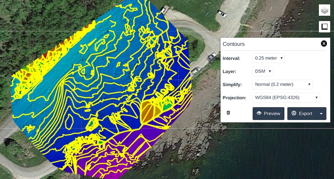
Piero just announced completion of contour support in WebODM, which is the web front-end to the ODM processing suite. This is some powerful geospatial software, and a great example of what a committed team can do with open source. The new contour capability leverages the GRASS engine as well as GDAL to process, then allows you to export to GIS. I can’t wait to try it out.
Related Posts
- OpenStreetMap is Having a Moment — Joe Morrison updates us on the state corporate investment in OpenStreetMap.
- Weekend Reading: Blot, Hand-Drawn Visualizations, and Megafire Detection — A new blogging tool, the complexity of hand-drawn visualizations, and detecting wildfires from satellites.
- mapwith.ai — An extension to the iD editor for automated feature detection.